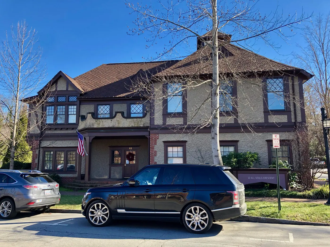
Biltmore Village, the planned village at the Biltmore Estate gate, is a city historic district in ZIP code 28803, split between the Reynolds and Roberson zones.
Last checked Oct. 11, 2026. Sources: the City of Asheville’s historic districts page, its Biltmore Village design standards, Book 1 and development plan, Buncombe County’s school district map layer, the N.C. Department of Public Instruction’s 2025-26 accountability data, the U.S. Census Bureau’s geocoder, OpenStreetMap and Zillow Research.
Biltmore Village is the small planned village outside the gate of the Biltmore Estate, where Biltmore Avenue becomes Hendersonville Road. The city’s design standards describe “the historic design concept for the Village as it was envisioned by its founder, George Vanderbilt, and his designers, Frederick Law Olmsted, Richard Morris Hunt, and Richard S. Smith.” Today its cottages and blocks are mostly shops, galleries, restaurants and offices, with apartments and houses around its edges. It is in ZIP code 28803.
What this means for you
- Zoned high school: depends on the street: T.C. Roberson High (66.7% of state tests at grade level in 2025-26) for most points we checked, or A.C. Reynolds High (66.4%).
- Home value: $437,927 in ZIP code 28803 in August 2026, according to the Zillow Home Value Index.
- Nearest interstate exit: I-40 Exit 50, U.S. 25, about 1.3 miles by road from All Souls Crescent.
Part of our Asheville neighborhoods guide.
Where it is
OpenStreetMap places the village around All Souls Crescent, Lodge Street, Swan Street and Boston Way, east of the estate gate. The design standards say its street plan keeps views “contained within the Village so that the ‘outside world’ does not intrude,” with two exceptions: Hendersonville Road, “originally Biltmore Road,” and Brook Street. Richard Morris Hunt designed four of its buildings: “All Souls Episcopal Church and Parish House, Railway Depot, and the Biltmore Estate Office.” The city’s development plan traces settlement here, on the Swannanoa River, to 1784.
Design review. Biltmore Village is one of the city’s local historic districts, so “all properties located within the boundaries” are “subject to design review,” according to the city’s historic districts page. It is also a National Register historic district.
City or town? Three of the four points we checked were inside Asheville on the Census Bureau’s geocoder. One on Biltmore Avenue south of the village was in the Town of Biltmore Forest, a separate town with its own tax rate.
Schools
Biltmore Village is in Buncombe County Schools, and its zones split. On Buncombe County’s school district map layer, points at OpenStreetMap’s village marker, on Swan Street and on Biltmore Avenue to the south were zoned for W.W. Estes Elementary, Charles T. Koontz Intermediate, Valley Springs Middle and T.C. Roberson High. A point on All Souls Crescent was zoned for Oakley Elementary and the A.C. Reynolds schools.
Scores are the share of state tests at grade level or above in 2025-26 and the state’s growth rating, from the accountability data.
| Zone | School | At grade level | Growth |
|---|---|---|---|
| Roberson | W.W. Estes Elementary | 63.2% | Met |
| Roberson | Koontz Intermediate | 56.3% | Not met |
| Roberson | Valley Springs Middle | 65.9% | Exceeded |
| Roberson | T.C. Roberson High | 66.7% | Exceeded |
| Reynolds | Oakley Elementary | 46.1% | Met |
| Reynolds | A.C. Reynolds Middle | 55.7% | Exceeded |
| Reynolds | A.C. Reynolds High | 66.4% | Met |
Roberson’s four-year graduation rate was 92.4%; Reynolds’ was above 95%. Buncombe County Schools is at 828-232-4160. More in our schools guide.
Home values
Zillow publishes no figure for Biltmore Village. The Zillow Home Value Index is a modeled typical value for the middle third of homes, not a sale price.
| Area | August 2026 | August 2025 | Change |
|---|---|---|---|
| ZIP code 28803 | $437,927 | $463,251 | -5.5% |
| City of Asheville, for comparison | $448,688 | $472,411 | -5.0% |
Trends are on our home prices page.
Parks and trails
The city’s park finder lists no city park inside the village. The nearest are in Kenilworth, to the north: Seven Springs, Meadow and Forest parks at 4 Caledonia Road, and Kenilworth Park, 79 Wyoming Road. To the east, Murphy-Oakley Park is at 715 Fairview Road. More in our parks and trails guide.
Getting around
- I-40: Exit 50, U.S. 25, signed for Asheville and Biltmore House, is about 1.3 miles by road from All Souls Crescent.
- Downtown Asheville: about 2.1 miles by road.
- Asheville Regional Airport: about 11 miles by road.
- Buses: four ART routes pass through the village: the S1 (to Shiloh and Medical Park), S3 (Hendersonville Road and the airport), S5 (Fairview Road) and S6 (Hendersonville Road to Biltmore Park), on the city’s maps and schedules page.
Distances were measured with the OSRM routing engine on OpenStreetMap roads from All Souls Crescent. They are distances, not drive times. More in our getting around guide.
Groceries and everyday stores
OpenStreetMap lists an Ingles at 780 Hendersonville Road, south of I-40, as the nearest full supermarket. Hopey & Co Grocery is at 800 Fairview Road in Oakley.
Frequently asked questions
Is Biltmore Village a historic district?
Yes. It is one of Asheville’s local historic districts, so exterior work on its properties goes through the city’s design review, and it is also listed on the National Register of Historic Places, according to the city’s historic districts page.
What high school is Biltmore Village zoned for?
It is split. Three of the four points we checked, including Swan Street, were zoned for T.C. Roberson High; one on All Souls Crescent was zoned for A.C. Reynolds High. Both are Buncombe County Schools.
Who designed Biltmore Village?
George Vanderbilt’s designers Frederick Law Olmsted, Richard Morris Hunt and Richard S. Smith, according to the city’s Biltmore Village design standards. Hunt designed All Souls Church and Parish House, the railway depot and the Biltmore Estate Office.
What is the typical home value in Biltmore Village?
Zillow publishes no Biltmore Village figure. Its typical value for ZIP code 28803 was $437,927 in August 2026, down 5.5% in a year.
Have your say