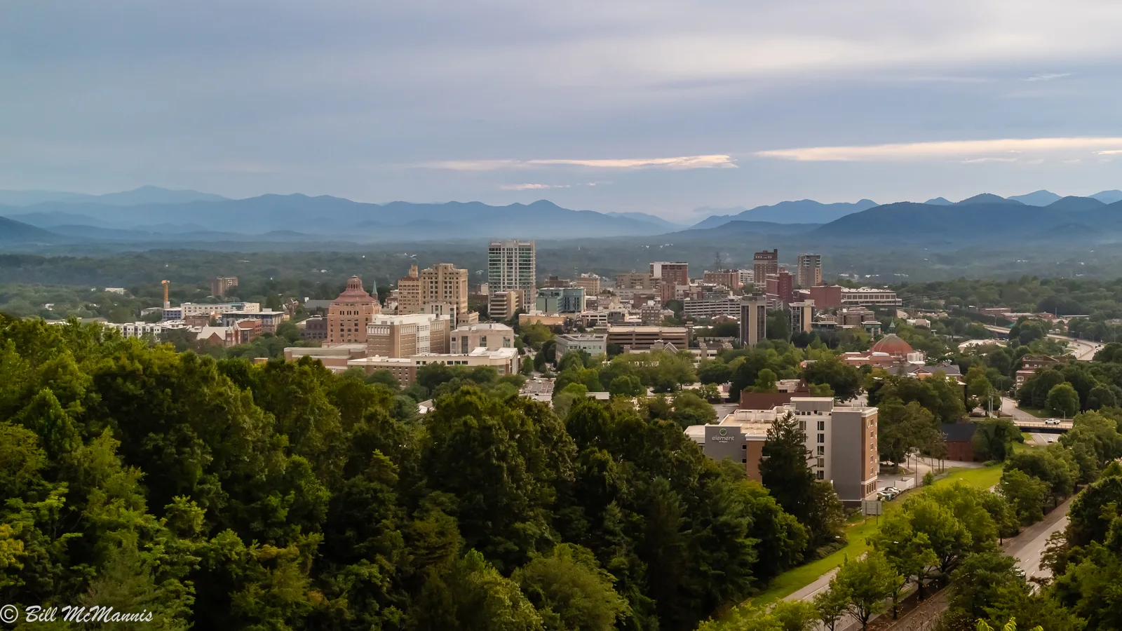
Asheville's 11 main areas, with ZIP codes, zoned high schools and Zillow home values. Two school districts split the city, and their line ignores city limits.
Last checked Oct. 11, 2026. Sources: the City of Asheville’s neighborhood plans and historic districts pages, OpenStreetMap, Buncombe County’s school district map layer, the N.C. Department of Public Instruction’s 2025-26 accountability data, the U.S. Census Bureau’s geocoder and Zillow Research.
Asheville is a city of about 94,000 people in a mountain bowl where the French Broad and Swannanoa rivers meet, according to the Census Bureau’s 2019-2023 American Community Survey. Three interstates shape it: I-240 loops around the north and west sides of downtown, I-40 crosses the south side past Biltmore Village, and I-26 runs west and south toward the airport. West of the French Broad is West Asheville; east of Beaucatcher Mountain is East Asheville along Tunnel Road; Hendersonville Road and Sweeten Creek Road carry the city south.
Five ZIP codes cover most of the city: 28801 (downtown and the neighborhoods around it), 28804 (north), 28805 (east), 28803 (south, from Kenilworth to Biltmore Park) and 28806 (west). Parts of each reach beyond the city limits, and neighboring towns such as Woodfin and Biltmore Forest share them.
School zones do not follow the city limits. Asheville has two public school districts: Asheville City Schools, whose families can choose among its schools at every grade level, and Buncombe County Schools, which zones each address to an elementary, middle and high school. Of the 72 points we checked across the city, West Asheville changed district from street to street, and every point in East Asheville, Oakley, Biltmore Village, Shiloh and South Asheville was in the county district, including those inside the city limits. Always check the address.
What this means for you
- Check the school district first. Look up the address on Buncombe County’s school district map layer, then confirm with Asheville City Schools enrollment (828-350-6111) or Buncombe County Schools (828-232-4160).
- Check the city limits. Homes inside Asheville pay the city’s 50.78-cent tax rate on top of the county’s 61.54 cents per $100; homes in the city school district add 11.75 cents. See property taxes.
- Home values fell everywhere this year. Every Asheville ZIP code’s typical value was lower in August 2026 than a year earlier, by 2.5% to 5.9%, according to the Zillow Home Value Index.
Asheville’s areas at a glance
Home values are Zillow’s typical value for the area’s main ZIP code in August 2026, a modeled value for the middle third of homes, not a sale price. High schools are from the points we checked on the county’s school district map.
| Area | ZIP code | Zoned high school | Typical value in ZIP | Guide |
|---|---|---|---|---|
| Downtown | 28801 | Asheville High | $551,288 | Downtown |
| Montford | 28801 | Asheville High | $551,288 | Montford |
| River Arts District | 28801 | Asheville High | $551,288 | River Arts District |
| North Asheville | 28804 | Asheville High | $583,670 | North Asheville |
| Kenilworth | 28803 | Asheville High | $437,927 | Kenilworth |
| West Asheville | 28806 | Asheville High or Erwin High | $393,020 | West Asheville |
| East Asheville and Haw Creek | 28805 | A.C. Reynolds High | $441,672 | East Asheville |
| Oakley | 28803 | A.C. Reynolds High | $437,927 | Oakley |
| Biltmore Village | 28803 | T.C. Roberson or A.C. Reynolds High | $437,927 | Biltmore Village |
| Shiloh | 28803 | T.C. Roberson High | $437,927 | Shiloh |
| South Asheville | 28803 | T.C. Roberson High | $437,927 | South Asheville |
For comparison, Zillow’s typical value for the whole city was $448,688 in August 2026, down 5% in a year. More on our home prices page and in our schools guide.
The areas
Downtown. The center of the city inside the I-240 loop. The city’s 2009 Downtown Master Plan describes five districts: the traditional core, Eagle/Market, Beaucatcher Gateway, the South Slope and Patton/River Gateway. Mostly apartments and condominiums. Read more.
Montford. The historic district just northwest of downtown, bounded by I-240, Broadway, Hill Street and Riverside Drive, with houses built mostly from the 1890s to the 1920s. Read more.
River Arts District. Former warehouses and mills along the east bank of the French Broad, now studios and apartments, on the Wilma Dykeman Greenway; flooded by Helene in 2024. Read more.
North Asheville. Older neighborhoods up Merrimon Avenue and Charlotte Street, including Grove Park-Sunset Mountain, Norwood Park, Albemarle Park, Grace and Lakeshore Heights, with UNC Asheville in the middle. Read more.
Kenilworth. A 1914 suburb on Beaucatcher Mountain’s southeast slope, once its own town, with more than 1,500 homes. Read more.
West Asheville. Everything across the French Broad, strung along Haywood Road, plus Wilshire Park, Malvern Hills, Falconhurst and Gaia Village; split between the two school districts. Read more.
East Asheville and Haw Creek. Tunnel Road, the Asheville Mall, Beverly Hills and Parkway Forest, and the Haw Creek valley to the north, part of it outside the city limits. Read more.
Oakley. The neighborhood around Fairview Road and Murphy-Oakley Park, between Biltmore Village and Beverly Hills, annexed in 1960. Read more.
Biltmore Village. The planned village at the Biltmore Estate gate, a local historic district where exterior changes need design review. Read more.
Shiloh. A neighborhood of bungalows and ranch houses between Hendersonville and Sweeten Creek roads, moved to its present site in the 1880s when the Biltmore Estate was assembled. Read more.
South Asheville. Hendersonville Road and Sweeten Creek Road south to Biltmore Park, with Cimarron, Hollybrook, Ballantree, Park Avenue, The Views and Givens Estates. Read more.
Comparing Asheville with the towns next door? See Asheville vs Woodfin vs Fletcher vs Black Mountain.
Map
Each area’s position on these pages comes from the city’s planning maps and from place names in OpenStreetMap, © OpenStreetMap contributors, available under the Open Database License. The city’s own maps of its five planning areas are on its neighborhood plans page.
How we built this
- The areas come from the City of Asheville’s neighborhood plans page, which groups the city’s neighborhood plans into North, Central, East, West and South areas, from the plans on a page that neighborhood associations filed with the city (Montford, Kenilworth, Oakley, Shiloh, Haw Creek, East-West Asheville, 5 Points, Grove Park-Sunset Mountain, South Slope and the Sweeten Creek neighborhoods), from the city’s small area plans (Downtown, Shiloh, Burton Street, Haywood Road, the Wilma Dykeman RiverWay) and its historic districts page, and from neighborhood and suburb place names in OpenStreetMap.
- We folded the South Slope into Downtown and Haw Creek into East Asheville, because the city’s plans place them there. We left out places OpenStreetMap names outside the city limits, such as Candler, Enka and Leicester, and the separate towns of Woodfin and Biltmore Forest.
- School zones and city limits come from 72 points we placed across the 11 areas and checked on Buncombe County’s school district map layer and the Census Bureau’s geocoder. They show the pattern; they do not replace a check of a specific address.
- School scores are the 2025-26 share of state tests at grade level and the state’s growth rating from the N.C. Department of Public Instruction. Home values are Zillow’s August 2026 ZIP code figures. Distances were measured on OpenStreetMap roads with the OSRM routing engine and are distances, not drive times.
- We do not rank neighborhoods or say which is better. Every page sticks to figures you can check.
Frequently asked questions
What are the main neighborhoods in Asheville?
The city groups its neighborhoods into five planning areas: North, Central, East, West and South. Our guide covers 11 areas within them: Downtown, Montford, the River Arts District, West Asheville, North Asheville, East Asheville, Kenilworth, Oakley, Biltmore Village, Shiloh and South Asheville.
Which Asheville neighborhoods are in Asheville City Schools?
Downtown, Montford, the River Arts District, North Asheville, Kenilworth and the eastern half of West Asheville were in Asheville City Schools at the points we checked. East Asheville, Oakley, Biltmore Village, Shiloh and South Asheville were in Buncombe County Schools.
Which Asheville ZIP code has the highest home values?
28804, north Asheville, where Zillow’s typical value was $583,670 in August 2026. 28806, west Asheville, was lowest at $393,020.
Do Asheville school zones follow the city limits?
No. Asheville City Schools and Buncombe County Schools both serve parts of the city. West Asheville changes district from street to street, and points inside the city limits in East Asheville, Oakley and South Asheville are all in the county district.
How do I find which school an Asheville address is zoned for?
Check the address on Buncombe County’s school district map and confirm with the district: Asheville City Schools enrollment at 828-350-6111 or Buncombe County Schools at 828-232-4160.
Have your say